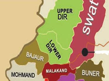
 Photos of Upper Dir.
Upper Dir is a District of Malakand Division in Khyber-Pakhtunkhwa Province. It lies along the Afghanistan border between Chitral, Bajaur Agency and Lower Dir District. The district was formed in 1996, when Dir District was divided into Upper Dir and Lower Dir.
Dir town is the Headquarters of Upper Dir District. It is sometimes known as Dir Proper or Khas Dir to distinguish it from the district. It lies at the foot of the Lowari Pass, the main road to Chitral, on the Dir River. Dir town was founded in the 17th century by Akhund Baba. It was the capital of the former princely state of Dir, until its abolition in 1969. The former royal palace is on a hill above the town. It was replaced as capital by Timergara, before the district was divided in 1996 into two districts (Upper Dir and Lower Dir).
Pushto is the main language spoken in the town. A few people speak Hindko, Gujri and Khowar (Chitrali). The majority of the population in this area are Yousafzai (Malizai), Roghani, Utmankheil, and Mianghan while the ruling class was Khosro.
Brief History: At the end of the 14th century the territories surrounding Dir were populated by the Pakhtuns who were divided in several clans (khels), who battled against each other. The three great clans which conquered the zone were the Yusafzai, Tarkanrai and the Utman Khel. The Dir territory was populated in the 16th century by the Malizai tribe of the Yusufzai Khel, who took control of the zone by chasing away the previous inhabitants, and within this tribe the most prominent fractions became the Painda Khel and Sultan Khel.
Akhund Mullah lIyas Painda Khel of the Malizai tribe lived in Dir in the 17th century. He was recognized as spiritual leader and was known as Akhund (“scholar” in Persian) Baba. Dir village was founded by Akhund Baba. By the 18th century a section of the Painda Khel, coming from the Kohan village in the valley of Nihag (a Panjkora tributary), seized the trade routes with Chitral and Afghanistan.Akhund Baba’s successors expanded the domain into an autonomous political entity which would eventually become the princely state. The clan of Mullah Ilyas Khan assumed the name of Akhund Khel and a dynasty was recognized as Khans (rulers) of Dir. However, till the end of the 19th century, the dominion of the family was limited to the upper Dir.
In 1881 the ruler of Dir, Muhammad Sharif Khan, was chased away by Khan Umra Khan of Jandool, who conquered Dir, Swat and the Malakand area. In 1895 while the forces of Umara Khan were besieging a British force near Malakand, Muhammad Sharif Khan made alliance with the British relief force coming in aid to the Chitral Expedition. Sharif Khan made an agreement with the British Government to keep the road to Chitral open in return for a subsidy. The British eventually won the war and exiled Umara Khan. The British annexed Dir in 1897 and demarcated its boundaries. As a reward for his help, Sharif Khan was given the whole Dir and also the lower Swat (the territory would later be lost in 1917 to the Wali of Swat).Some years later he received the title of Nawab.
After independence of Pakistan, Dir still enjoyed the status of a separate state, but was amalgamated with Pakistan in 1960 as a tribal agency. It was finally merged as a district with the Khyber Pakhtunkhwa (then NWFP) on 28 July 1969. The royal status of the Nawabs was abolished in 1972. In 1996, due to administrative constraints, Dir District was divided into two districts; Lower Dir and Upper Dir.
Prayer Timings in Dir: Please click this link for the Prayer Timings in Dir.
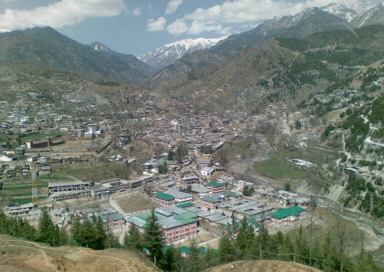
Photos of Upper Dir: Panoramic View of Dir Town. Photo by Majid Khan.
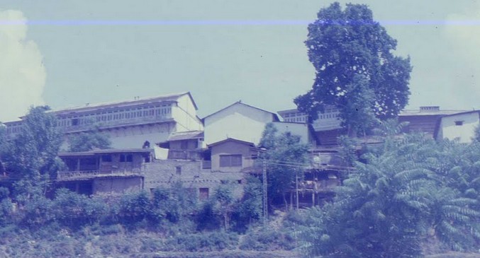
Photos of Upper Dir: View of Dir Palace from Chitral Road. Photo by Shamrock46.
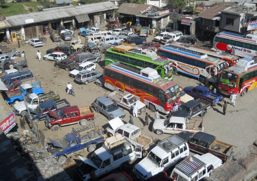
Photos of Upper Dir: Bus Stand of Dir Town. Photo by abuibrahim.
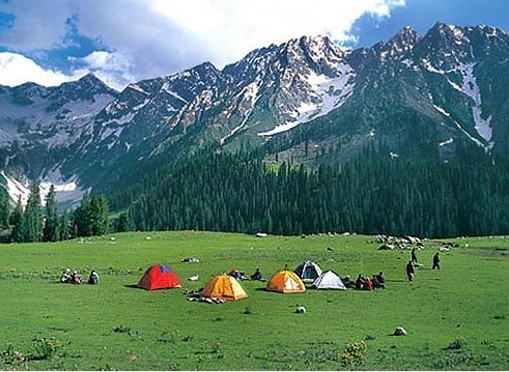
Photos of Upper Dir: Colourful Tents at the Magical Kumrat Valley. Photo taken by little spy007 on 06 July 2008.
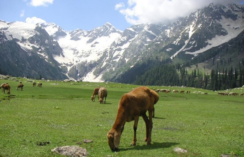
Photos of Upper Dir: Sheep grazing at Jahaz Banda. Photo by ikram ul haq.
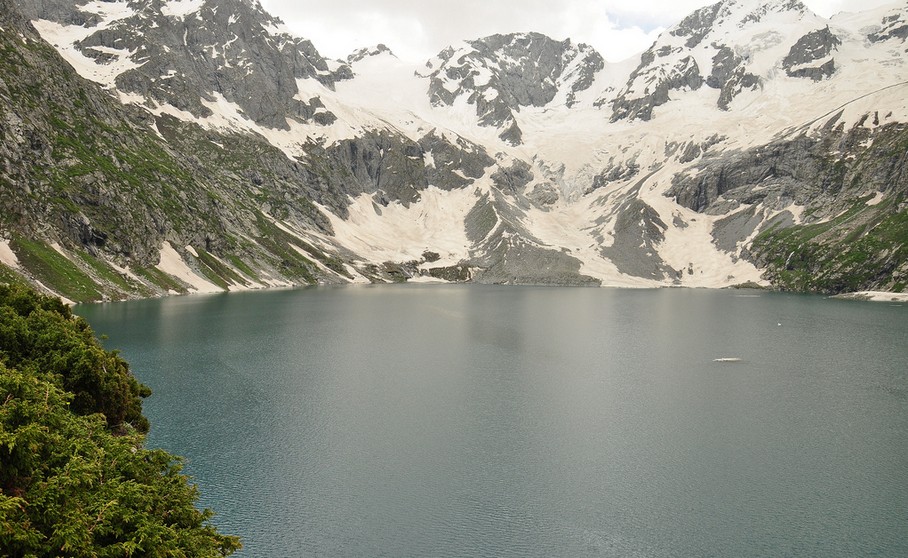
Route: Dir town to Thall (80 km) is 5.5 hours drive on a jeep. From Thall to Jandrai (10 km) is another 30 minutes drive on jeep. From Jandrai to Jahaz Banda (10 Km) is 4.5 hours trekking. From Jahaz Banda to Jahaz Dand Lake (5 Km) is another trekking of 3 hours.
Photos of Upper Dir: Jahaz Dand Lake. Photo by Asif Saeed . Jahaz Dand is located at approx 3500 m altitude, 3 hours trek from Jahaz Banda in Upper Dir.
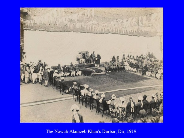
Photos of Upper Dir: The Nawab Alamzeb Khan’s Durbar, Dir, 1919. Photo from a collection compiled by Lieutenant Colonel G J Davis, 1919.
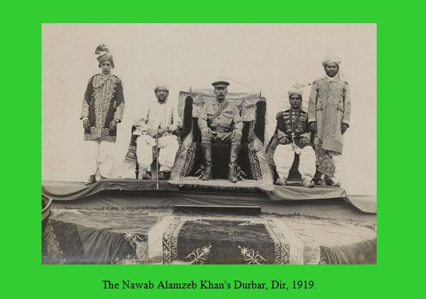
Photos of Upper Dir: Nawab of Dir’s Durbar, 1919. Photo from a collection compiled by Lieutenant Colonel G J Davis, 1919.
Related Pages:
Photos of Lower Dir
Photos of KPK
Editor’s Note: If you have liked this post (Photos of Upper Dir), then please share it on Facebook and Twitter or any other Social Media.
Visitors of this site can send their photos of Upper Dir to: rashid.cheema11@gmail.com
Please also write your brief comment at the end of this page under the heading “Leave a Reply here”.
 Large Visitor Globe
Colourful knowledge, keep it up to share with people.
Yes, this website has shown a great place of our country, although I heard about this place but not visited through Internet ever before.
Fascinating article. Loved reading about the historical development of the Lower and Upper District Regions, along with great pictures. The Timargara fields look very much like the Cahokia Mounds (Native American Sacred Hills) near Southern Illinois, just across the river from St. Louis, Missouri. I wish the Timargara fields remain beautiful and unspoiled. Are there planned archaeological excavations? Thank you so much!!
Thanks for adding this Post. Please also add old photos of Lower Dir.
Dear Rahib Shah,
Many photos of Lower Dir District have now been added on your demand. Old photos will also be posted as and when those are available. Please click the following link to see the photos:
Photos of Lower Dir
Thanks for such a informative article with pictures. You have increased my knowledge regarding this portion of our beloved country. Thanks again. Regards.
You have introduced me to this part of our country about which I hardly knew anything.
Thanks.